KAIBETO TRADING POST MAPS AND NOTES
See photos of tradiing post: kaibeto2

 14
14
 15
15
 16
16
Kaibeto letter 092552 Ralph to Anne (Word)
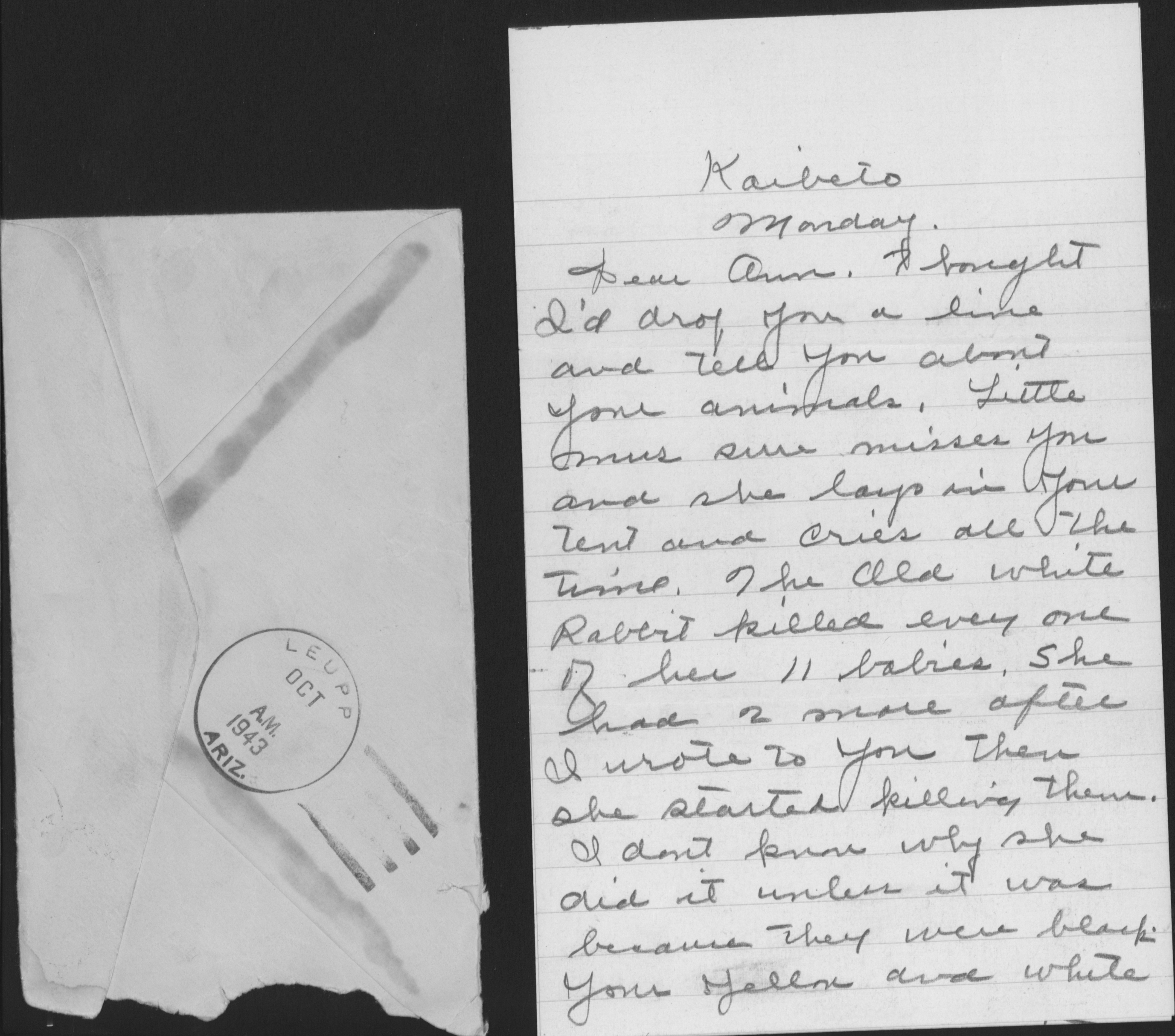
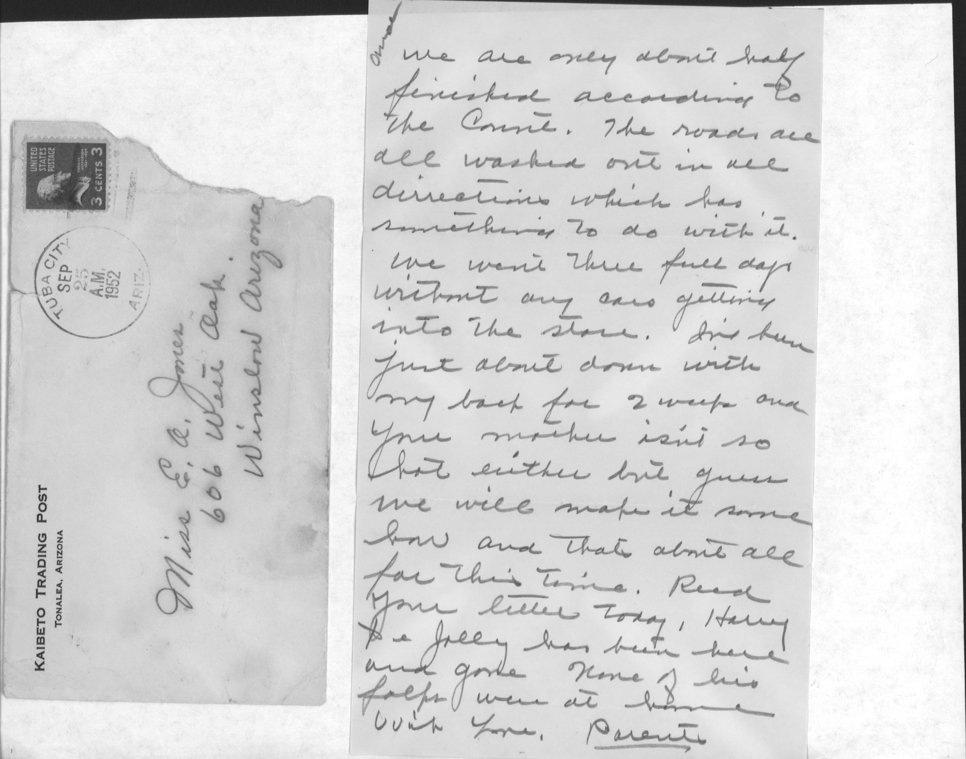
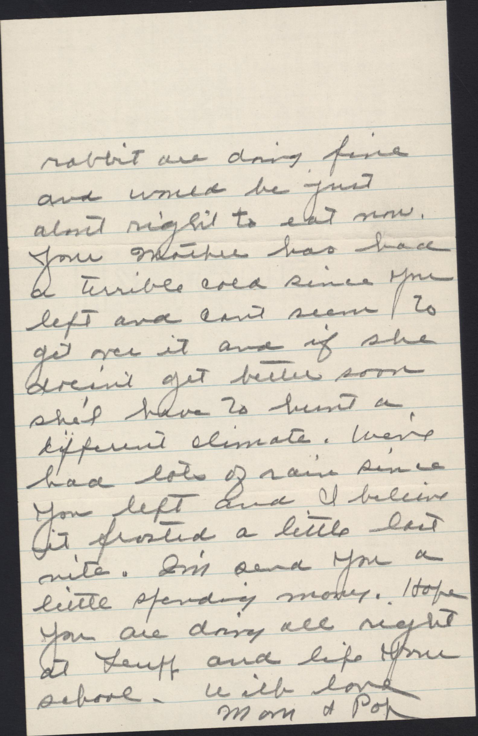
Letter postmarked Sep 25 A.M. 1952 at Tuba City, Ariz., 3 cent stamp; printed return address is Kaibeto Trading Post, Tonalea, Arizona. Addressed to Miss E.A. Jones, 606 West Oak, Winslow, Arizona Wed Eve (marked 1952 but in a different writing style than the rest of the letter) Supervision will be coming by in a few minutes to take the mail out and thus no Super Humans in here at the moment so I’ll drop you the latest scandal Arline Owens[should redact this name?] has a 5 ½ lb baby girl the other day I understand she is trying to adopt it out The sheep are coming in awful slow this year We have been buying two weeks now We are about half finished according to the Count. (sp?) The roads are all washed out in all directions which has something to do with it. We went three full days without any cars getting into the store I’ve been just about down with my back for 2 weeks and your mother isn’t so hot either but guess we will make it some how and that’s about all for this time. Read your letter today, Harry [?] x Jolly [?] has been here and gone. None of his folks were at home. With love, Parents
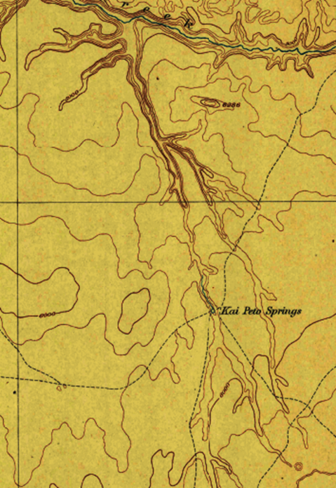
USGS topo map 1891 1937 edition
I’ve copied a USGS topo map of Echo Cliffs, AZ dated 1897 and produced under the directorship of John Wesley Powell (who first floated through Grand Canyon)/
That map shows Kaibeto Springs as an isolated feature in the region we know. The springs is at the junction of four long trails.
Since you have found the trading post was built around 1914, we now know the springs were name before that—and that the post was bult within 1/3 mile of the springs, likely using the springs as the source of its water.
It is all the more likely the post is named for the springs,

Maps below are reference only; not to be included in book
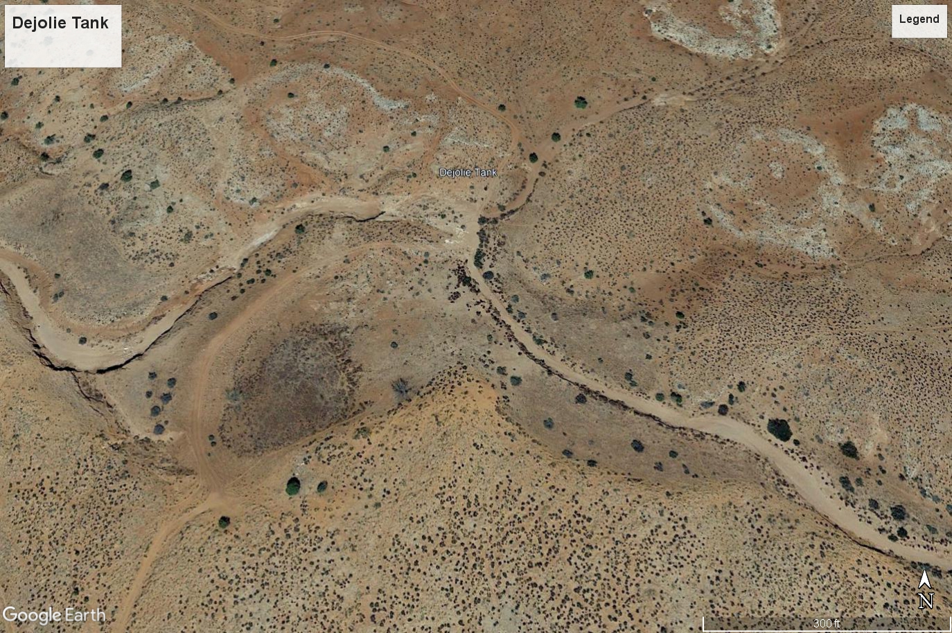
Dejolie Tank (at site of former Frenchman's Lake) from U.S. Geological Survey topographic maps
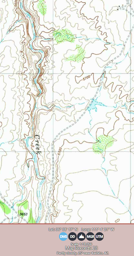
1891 (1937 edition) Echo Cliffs topo map does not show pond or lake in area where Dejolie Tank shows on later maps.
1956 (1964 edition) Marble Canyon topo map shows unnamed pond with dam (just below 5500 foot contour line) on unnamed intermittent tributary perhaps a mile upstream from junction with Kaibito Wash (now Kaibito Creek) named elsewhere on larger map. The black square at the end of the dashed line at bottom indicates a structure; who might have been involved with this structure in 1956 and what might they know about these names and their history? Does the fact that a dam shows on this body of water indicate that dam did not fail in 1952 but at some later time?

1982 White Hill topo map shows the name Dejolie Tank as an intermittent body of water perhaps a mile upstream from junction with named Kaibito Creek. There is no dam shown. There is an unimproved road leading to it.
But here is another tank off Kaibito Creek south of Dejolie Tank but north of the highway. Google Earth aerial photo shows a vegetation pattern here that might indicate an ephemeral pond here. Was this Frenchman's Lake? It is not as convincing as Dejolie Tank being Frenchman's Lake.
White Hill 2018 topo map shows Dejolie Tank tank about dried up; stippled patterns shows sand where intermittent water was:

map image from Topo North America 10 showing Dejolie Tank on the north about 10 miles off Hwy 98. An unnamed intermittent pond is circled in the south, about 3 miles north of Hwy 98. An unimproved road exits IR 6330 and leads past Dejolie Tank Another unimproved road goes past the tank at the south:
Dejolie Tank from Google Earth Pro:
Road from southwest now drops down to shore of tank via a sand slope.
But the tank was much larger than in this section of a photo. See instead the photo of 08/2010 which shows a color change that matches the shape of the tank as shown on maps. There is a natural-looking ridge at the north end of that color change that if dammed would back up water just whee the color change is. It could be the color change is reflective of some moisture condition of that time and some soil condition from a former lake bed . The larger extent of this colored area perhaps was Frenchman Lake and Dejolie Tank is just a small remnant.,
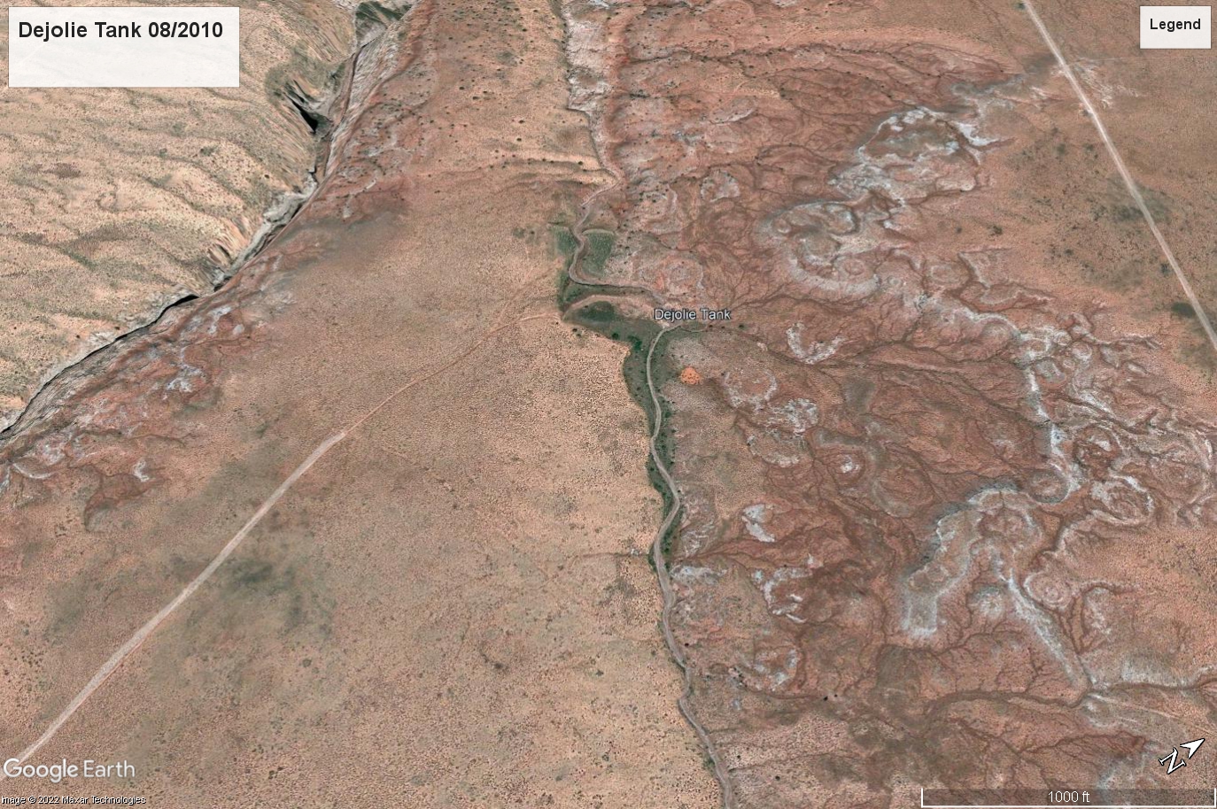
On the left side of the picture below, at the end of the road, is a sand slope leading to the edge of what was likely Frenchman Lake. At the upper part of the photo is a breached dam. When was it breached?

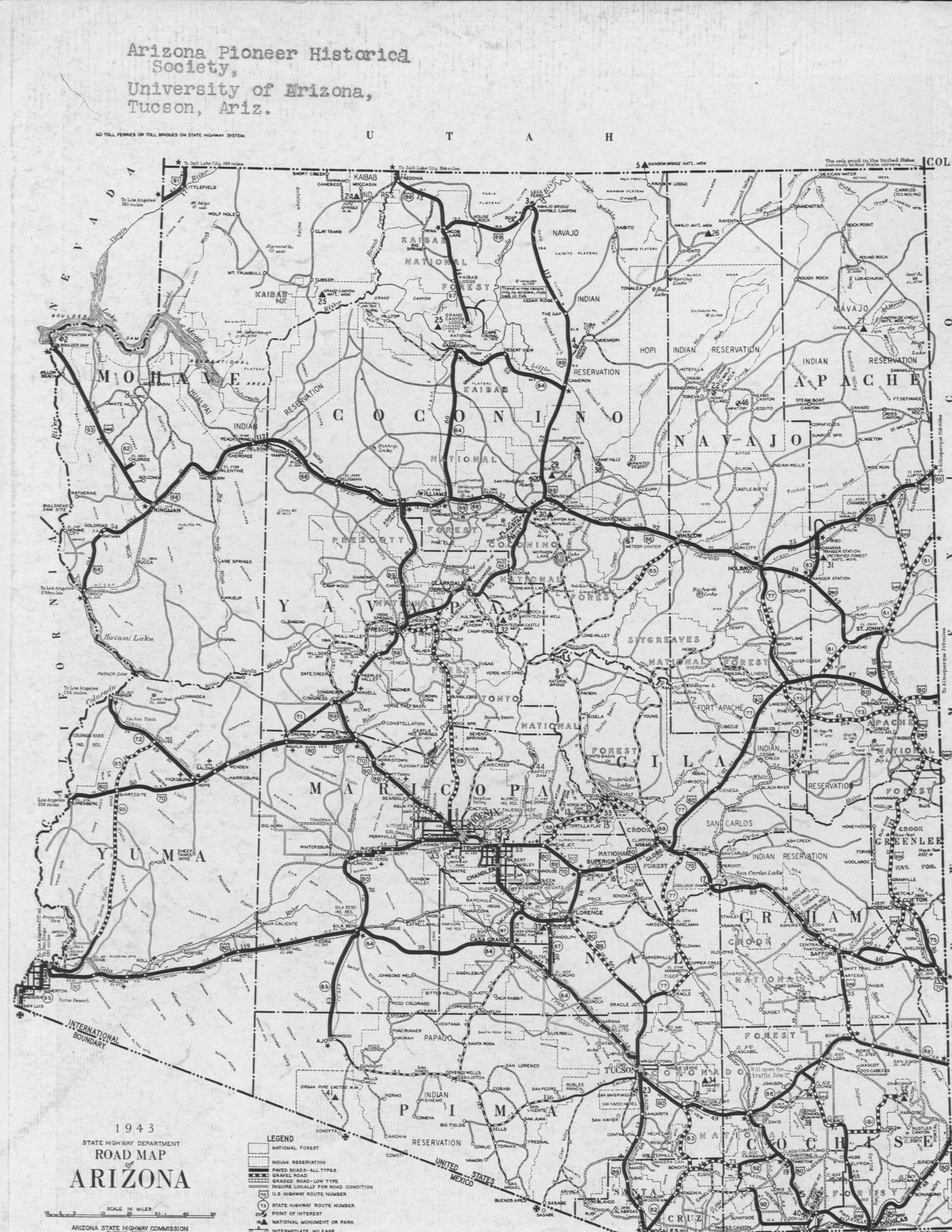
Map from back cover Arizona Hwys 1943

Kaibito map cropped from Arizona Hwys. Permission to use requested by letter 11/2/22
